|
|
|
Advertisements:
TransportationAirports
61 (2012)
Airports - with paved runways
Total 22
Over 3,047 m 2 2,438 to 3,047 m 2 1,524 to 2,437 m 13 914 to 1,523 m 5 (2012) Airports - with unpaved runways
Total 39
1,524 to 2,437 m 4 914 to 1,523 m 15 Under 914 m 20 (2012) Heliports
1 (2012)
Roadways
Total 2,717 km
Paved 1,560 km Unpaved Km 1,157 (2002) Merchant marine
Total 1,160
By type Barja transportator 1, vrachier 238, 170 de marfă, transportatorul 2, tanc chimic 87, combinaţie minereu/ulei 8, recipient 57, gaz lichefiat 71, pasageri 102, pasageri/mărfuri 26, petrol petrolier 225, marfă frigorifice 97, roll on / roll off tanc specializate 13, 2, vehicul de transport 61 Foreign-owned 1,063 (Angola 6, Australia 1, Belgia 6, Bermude 15, Brazilia 1, Canada 96, Croaţia 1, Cipru 23, Danemarca 69, Finlanda 8, Franţa 15, 30, Grecia-225, Guernsey 6, Hong Kong 3, Indonezia 2, 3, Italia 1, Irlanda Germania Japonia 88, Iordania 2, Kuweit 1, Malaezia 13, Monaco 8, Muntenegru 2, Olanda 23, Nigeria 2, Norvegia 186, Polonia-34, Arabia Saudită 16Singapore 7, Coreea de Sud 1, Spania 6, Suedia 11, Elveţia 1, Thailanda 4, Turcia 3, EAU 23, UK 18, SUA 109) Registered in other countries 6 (Panama 6) (2010)Ports and terminals
Freeport, Nassau, South Riding punct
Comentarii
Adauga un comentariu: |
Advertisement
Login
Bahamas (Nassau):
 
Puncte GPS din Bahamas (Nassau)
|
||||||||

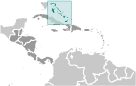 Lucayan indieni locuite Insulele atunci când Christopher COLUMBUS prima piciorul în lumea nouă pe San Salvador în 1492. Decontare britanice din Insulele a început în 1647; Insulele a devenit o colonie în 1783. Deoarece atingerea independența față de Marea Britanie în 1973, Bahamas a prosperat prin turism si managementul bancar şi investiţii internaţionale. Datorită geografiei sale, tara este un punct de transbordare majore pentru droguri ilegale, în special transporturile către SUA şi Europa, şi teritoriul său este utilizat pentru traficul ilegal de migranţi în SUA.