5°16'60" N
58°52'0" W
~17m asl
10:46 (GYT - UTC/GMT--4)
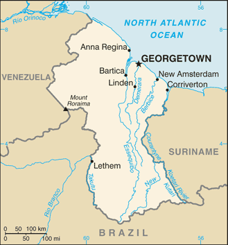
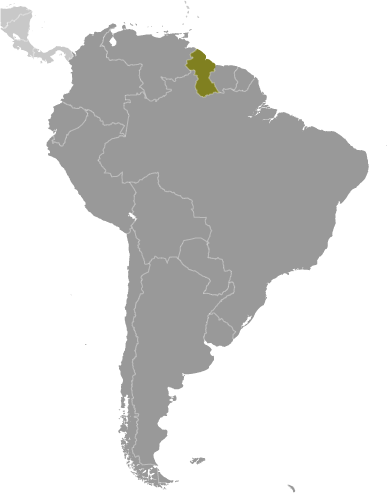
Benhori-bumoka Island (Benhori-bumoka Island) este un/o insula (class T - Hypsographic) în Upper Demerara-Berbice Region (Upper Demerara-Berbice), Guyana (South America), având codul de regiune Americas/Western Europe. Este situat(ă) la o altitudine de 17 metri deasupra nivelului mării.
Benhori-bumoka Island este de asemenea cunoscut(ă) şi sub numele de Benhori-Bumoko Island, Benhori-bumoka Island.
Coordonatele sale sunt 5°16'60" N şi 58°52'0" W în format DMS (grade, minute, secunde) sau 5.28333 şi -58.8667 (în grade zecimale). Poziţia sa UTM este TF98 iar referinţa Joint Operation Graphics este NB21-09.
Ora locală curentă este 10:46; soarele răsare la 08:54 şi apune la 21:01, ora locală (America/Guyana UTC/GMT-4). Fusul orar standard pentru Benhori-bumoka Island este UTC/GMT-4
În 2024, ora de vară este valabilă de la - până la -.
Insula este intindere de pamant, mai mica decat un continent, inconjurata de ape adanci.
|
Advertisements:
Advertisements:
|
Vremea Benhori-bumoka Island (Nebulozitate, Temperatură, Vânt si Precipitaţii mm probab.)
Sat
Apr 27
~1 l/m2 48%
22 °C min
32 °C max
7 km/h
Thu Jan 1
|
Sun
Apr 28
~1 l/m2 44%
22 °C min
34 °C max
7 km/h
Thu Jan 1
|
Mon
Apr 29
~6 l/m2 54%
22 °C min
34 °C max
7 km/h
Thu Jan 1
|
Tue
Apr 30
~26 l/m2 80%
23 °C min
29 °C max
6 km/h
Thu Jan 1
|
Wed
May 1
~12 l/m2 55%
22 °C min
31 °C max
6 km/h
Thu Jan 1
|
Thu
May 2
~15 l/m2 59%
22 °C min
32 °C max
8 km/h
Thu Jan 1
|
|
|
Benhori-Bumoko Island (Upper Demerara-Berbice Region) prognoza pe 7 zile
Harta si Fotografii Benhori-bumoka Island
--- Nu exista niciun comentariu ---
Adauga un comentariu:
|
Login
Guyana (Georgetown):
Advertisement
Puncte GPS langa Benhori-bumoka Island
Puncte GPS din Guyana (Georgetown)
|

 Konawaruk River (4 km)
  Mowasi River (4 km)
  Mowassi (4 km)
  Mowassi River (4 km)
  Wasi River (4 km)
  Waraputa Fall (5 km)
  Waraputa Falls (5 km)
  Blackwater Falls (5 km)
  Crystal Creek (5 km)
  Temple Bar Falls (5 km)
  Buro-Burok Rapids (6 km)
  Buro-buruk Rapids (6 km)
  Yesi Island (6 km)
  Cumings Rapid (7 km)
  Cummings Rapid (7 km)
  Star Creek (9 km)
  Tiger Fall (9 km)


