Nggatokae Island
8°46'0" S
158°10'59" E
07:45 (SBT - UTC/GMT+11)
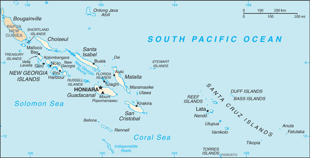
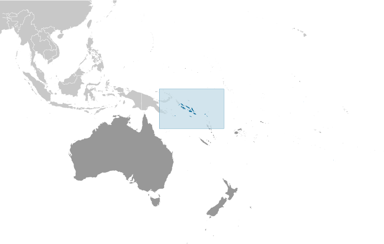
Nggatokae Island (Nggatokae Island) este un/o insula (class T - Hypsographic) în (Solomon Islands (general)), Insulele Solomon (Oceania), având codul de regiune Asia/Pacific.
Coordonatele sale sunt 8°46'0" S şi 158°10'59" E în format DMS (grade, minute, secunde) sau -8.76667 şi 158.183 (în grade zecimale). Poziţia sa UTM este VL13 iar referinţa Joint Operation Graphics este SC57-02.
Ora locală curentă este 07:45; soarele răsare la 08:54 şi apune la 21:01, ora locală (Pacific/Guadalcanal UTC/GMT+11). Fusul orar standard pentru Nggatokae Island este UTC/GMT+11
În 2024, ora de vară este valabilă de la - până la -.
Insula este intindere de pamant, mai mica decat un continent, inconjurata de ape adanci.
|
Advertisements:
Advertisements:
|
Vremea Nggatokae Island (Nebulozitate, Temperatură, Vânt si Precipitaţii mm probab.)
Fri
Apr 26
~1 l/m2 31%
28 °C min
30 °C max
7 km/h
Thu Jan 1
|
Sat
Apr 27
~21 l/m2 67%
29 °C min
30 °C max
14 km/h
Thu Jan 1
|
Sun
Apr 28
~14 l/m2 63%
28 °C min
30 °C max
28 km/h
Thu Jan 1
|
Mon
Apr 29
~12 l/m2 58%
29 °C min
30 °C max
18 km/h
Thu Jan 1
|
Tue
Apr 30
~17 l/m2 46%
29 °C min
30 °C max
20 km/h
Thu Jan 1
|
Wed
May 1
~12 l/m2 45%
29 °C min
30 °C max
27 km/h
Thu Jan 1
|
|
|
Harta si Fotografii Nggatokae Island
--- Nu exista niciun comentariu ---
Adauga un comentariu:
|
Login
Insulele Solomon (Honiara):
Advertisement
Puncte GPS langa Nggatokae Island
Puncte GPS din Insulele Solomon (Honiara)
 Kolo Solomon Islands (general)
 Nakuhu Solomon Islands (general)
 Taora Solomon Islands (general)
|

 Gatukai Island (0.5km)
  Nggatokae Island (0.5km)
  Mount Mariu (1 km)
  Chakope (3 km)
  Chakopi (3 km)
  Chaleopi (3 km)
  Kavo Lavata (3 km)
  Kavo Lavata (3 km)
  Kio (4 km)
  Chukapaini (4 km)
  Kele (4 km)
  Kele (4 km)
  Susaka (4 km)
  Vahu (4 km)
  Volivoli (4 km)
  Malasomba (4 km)
  Sombiro (4 km)


